
In trail running, understanding cumulative elevation is as crucial as knowing the distance. The cumulative elevation greatly influences the difficulty of a trail, making it essential to learn how to calculate various types of elevation. This article will guide you through the process and illuminate why cumulative elevation ranks as the most widely used metric in trail running, helping you choose the trail that best suits your preferences 😉 So, how do we calculate positive elevation in trail running?
Contents
What is positive elevation gain and how to calculate it ?
Elevation gain signifies the difference in altitude between the starting and finishing points of your race. For instance, if the race starts at 100m above sea level and concludes at 600m, the positive elevation gain would be 500m (600 – 100 = 500).
Notably, some races, like the UTMB (Ultra Trail of Mont-Blanc), have a zero elevation gain as the start and finish occur at the same location 😉 Therefore, cumulative elevation becomes a more meaningful metric for assessing trail difficulty.
Calculating cumulative elevation gain, D+ and D- :
During a race, organizers accumulate the altitude gained and lost during ascents and descents, resulting in the cumulative elevation gain. Consider a race with a 200m ascent followed by a 300m descent, and then another 600m ascent with a 100m descent. The cumulative elevation gain would be 1200m. The famous 6000D in La Plagne uses this calculation. It is also often used during hikes.
When looking only at ascents, we refer to cumulative positive elevation gain: the famous D+. In our example, the cumulative positive elevation gain is 800m. D+ is prevalent in the trail running community, with renowned races like the UTMB boasting a D+ of 10,000m.
Additionally, the cumulative negative elevation (D-) is a valuable indicator, signifying the impact of downhill portions on the overall trail difficulty.
Is D+ the primary indicator of trail difficulty?
In trail running, difficulty is influenced by both distance and positive cumulative elevation. For example, a 20km race with a 1000m D+ would be more challenging than a trail covering the same distance with a 500m D+. Organizations like ITRA classify using the “flat distance” concept, incorporating kilometers and D+ in hectometres (100m). However, this measure is theoretical, and precise calculations of equivalent flat speed (Grade Adjusted Pace) consider technical aspects and slope percentages using other coefficients.
Choosing the right trail: select a trail aligned with your abilities and experience. Before registering, thoroughly examine the course profile to ensure it suits your preferences and skill level.
How GPS and barometric watches calculate positive elevation gain?
According to a study conducted by Sportlab, 44% of runners prefer using a connected watch. These sophisticated timepieces not only calculate distance, time, and pace but also track positive and negative elevations. When it comes to measuring altitude differences, two main types of watches dominate the market: GPS watches and barometric watches. Remarkably, some watches now integrate both technologies for even more accurate data.
Every GPS watch relies on signals from a minimum of three satellites. To ensure precise data, it’s essential to wait for synchronization between the watch and these satellites before commencing your session.
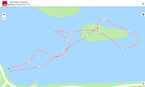
However, achieving optimal reception can be challenging, especially in densely forested areas or mountainous terrain. The interference between satellites in such environments often leads to irregularities in your GPS track. As illustrated below with the GPS track resembling that of a swimming outing, these disruptions can occur unexpectedly (as seen in the image: GPS track of a swimming outing… We’ll reconvene on the island).
Barometric watches are equipped with sensors that measure atmospheric pressure variations, enabling precise calculations of changes in altitude and elevation gain. In comparison to GPS watches, they boast superior accuracy; however, their performance is influenced by external factors, particularly changes in weather conditions.
The correlation between atmospheric pressure, altitude, and weather conditions is undeniable. In stable weather, barometric watches can deliver highly accurate altitude measurements. To enhance precision, some watches adopt a dual approach, combining both GPS and barometric technologies.
A third alternative, employed by platforms like Strava, involves utilizing the GPS track and overlaying it on detailed map models such as IGN. This allows for a recalibration of altitude variations based on the track, providing an additional layer of accuracy.