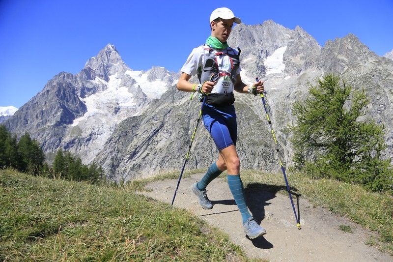
The CCC® is one of the flagship races of UTMB® Mont-Blanc. Its route covers much of the second half of the UTMB®, with a few key differences. If you dream of running the UTMB® one day, the CCC should be on your race calendar. This 100-kilometre ultra trail race, with 6,000 metres of elevation gain, starts in the centre of Courmayeur, Italy. Here are our top tips for managing your CCC® race.
Contents
CCC: A long and demanding first climb from Courmayeur
The UTMB® route passes through Courmayeur and the Bertone Refuge. Although the CCC® starts in Courmayeur, it does not head directly to Bertone.
The start in Courmayeur, at around 1,200 metres above sea level, creates a unique atmosphere in the village as Vangelis’ “Conquest of Paradise” plays. After roughly 1 kilometre through Courmayeur’s centre on flat ground, the gradient gradually begins to rise. The course is wide at first. Even when you reach the first trails, the track remains broad, following a 4×4 road.
The UTMB® climbs left towards the Bertone Refuge at kilometre 3, while the CCC® stays on the 4×4 track until kilometre 4.5, at the hamlet of Tsapy. Use these first 4.5 kilometres to settle into your rhythm. The singletrack starts just after the hamlet, and passing becomes very difficult all the way to Tête de la Tronche at kilometre 9.
Settling into your rhythm means neither going too fast nor too slowly. You have 1,000 metres of elevation gain in 4.5 kilometres, almost like a vertical kilometre, with a brief respite halfway up. Do not start too slowly and risk getting stuck behind a slow group, but do not go too hard either. Beyond holding up runners behind you, you could burn through too much energy with more than 90 kilometres still to run.
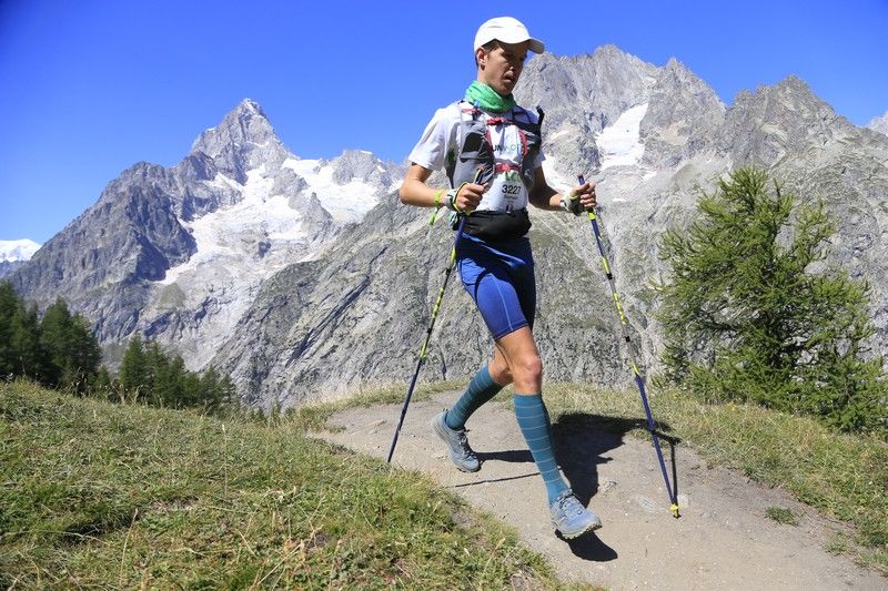
The key word on the climb to Tête de la Tronche, at 2,584 metres, is caution. If you are carrying poles, get them out as soon as the singletrack begins. Save your quads as much as possible.
CCC: From Tête de la Tronche to the Val Ferret
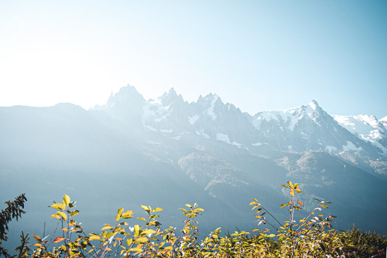
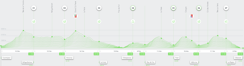
Once you reach the top of the seemingly endless Tête de la Tronche climb, it is time to head down towards the Bertone Refuge. You can start running again at a controlled pace. Bertone is at kilometre 13 of the CCC. If the weather is clear, take a moment to admire the majestic Mont Blanc directly in front of you, as well as the Grandes Jorasses.
Then comes 12 kilometres of balcony trail facing Mont Blanc, with a rolling profile and a constant series of small, mostly runnable climbs. Try to stay as relaxed as possible and avoid pushing the intensity on this section. Next, you begin the short but fairly steep descent to Arnouvaz at kilometre 25.
Crossing the Grand Col Ferret
You have reached the end of the Val Ferret, at least its lower section. Get ready to say ciao to Italy and climb around 750 metres to the Grand Col Ferret, at 2,537 metres. Often windy, this climb can feel very different depending on how your body is responding. If you have raced sensibly so far, it is steep but steady, and it goes by much faster than Tête de la Tronche. If you have already pushed too hard, your quads may already be feeling it.
You reach the border between Italy and Switzerland, less than 5 kilometres as the crow flies from Mont Dolent, the tripoint between France, Italy and Switzerland.
Welcome to Switzerland
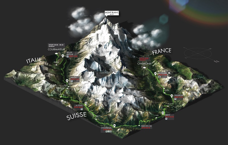
Switzerland gives you a warm welcome, not only through the villages you will encounter further on, but also with a first fast, runnable descent that lasts nearly 20 kilometres. Be careful though, it can be a trap 😉 It is easy to attack the descent towards La Fouly too hard. Some runners say this is where you can finally let loose.
In my opinion, that is a mistake. You still need to protect your quads and stay at an easy aerobic effort, or only just above it. The descent is long. Many runners overdo it and then have to walk for a long time to recover after La Fouly, even though the section from La Fouly to the foot of the Champex-Lac climb is highly runnable if you have not made any mistakes. The few seconds gained early in the descent to La Fouly can cost you several minutes of walking on the flats later on.
La Fouly is a typical village, with an aid station and wonderfully welcoming volunteers. The trails alongside the Dranse river are very pleasant and bring you back into the shade of the trees. You are now approaching the climb to Champex-Lac.
The climb to Champex-Lac
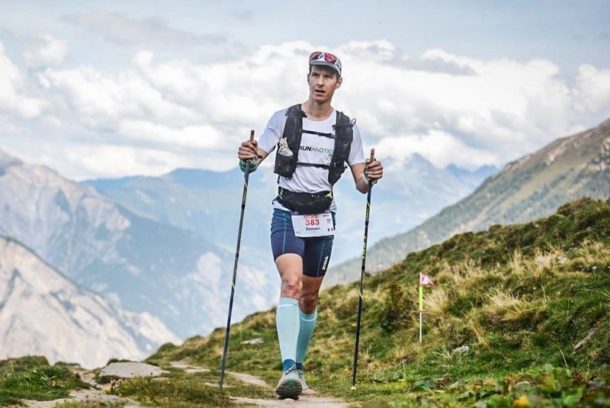
The climb to Champex-Lac is steep but relatively short, at around 400 metres of elevation gain. It bites into the quads after a long runnable section. Shorten your stride and use your poles to maintain a steady rhythm. At the top, you reach the beautiful Lake Champex.
The front runners have already passed through in the early afternoon, but many runners tackle this climb at night. At Champex, kilometre 53, an aid station awaits. People often say that the CCC really starts here, even though your quads are no longer feeling particularly fresh.
Do not hesitate to take a little time to reset and get going again properly. You still have a sequence of three climbs and descents ahead, each with 700 to 800 metres of elevation change: Bovine, Catogne and Tête au Vent.
The Bovine, Catogne and Tête au Vent sequence
Leaving Champex, the path alongside the lake is flat, and the section to the base of the Bovine climb is generally runnable.
The Bovine climb
Now you need to deal with legs that are no longer fresh and avoid overthinking things. The Bovine climb has a brief flatter section before a steep, but thankfully not overly long, ascent. The descent to Trient is fairly technical, so runners passing through at night will need to watch out for roots. You will be glad you practised your downhill running in training!
The Catogne climb
Another aid station awaits in Trient, a small Swiss village known for its pink church. You are at kilometre 70, and the next climb is once again very steep. Fortunately, the gradient eases towards the end. Once you crest Catogne, the descent to Vallorcine lets you move fairly quickly, first on a narrow path, then on a wider track towards the ski lifts, before a more technical forest descent into Vallorcine.
Vallorcine is the last full aid station. With just under 20 kilometres to go, if you are feeling good, you know you will make it to the finish. If you are struggling, you will need to restart cautiously for the slightly uphill 3-kilometre stretch to the Col des Montets.
The Tête au Vent and Flégère climb
At the Col des Montets, you can see the wall rising ahead for the final climb. At night, which is generally the case for runners between roughly 50th and 1,000th place, it has an almost poetic quality. You can see the fireflies of runners’ headlamps moving above you. This climb consists of rocky blocks, almost like steps.
The climb to Tête au Vent is legendary for CCC and UTMB runners. For those tackling it at night, the challenge is even greater, because after reaching Tête au Vent, the trail remains very technical all the way to La Flégère, with plenty of rocks. Runners in the top 50 and those in the second half of the field are treated to a spectacular view across the entire Mont Blanc range.
The CCC finish in Chamonix
Once you reach La Flégère, where there is a light aid station mainly offering drinks, you are almost there. The descent to Chamonix is about using whatever you have left. If you are exhausted or feeling pain, manage it as best you can. If you are feeling good, put your final reserves into this descent. It has plenty of switchbacks, but it is mostly runnable.
When you cross the Arve river, all that remains is to enjoy the final kilometre through the streets of Chamonix. Perhaps you are already imagining the finish arch and the applause in the streets. We will let you discover the finish-line atmosphere and the emotion of crossing that line for yourself 😉

CCC mandatory gear
The CCC has a mandatory equipment list, so make sure you review it carefully. Pay particular attention in difficult weather conditions, including rain, snow, cold and wind. And of course, bring your headlamp if you expect to spend a significant part of the race running at night.
For nutrition, aid stations are generally positioned every 10 to 15 kilometres, allowing you to refill your water regularly. You can also carry purées, bars or gels to top up your energy between aid stations. We recommend planning your ultra trail nutrition strategy well in advance.
For me, the 2021 CCC remains an unforgettable memory, with spectacular scenery, very favourable weather, almost a little too warm, and well-managed pacing that led to a 15:21 finish, in 147th place.
One month before the CCC, prepare your race strategy too
One month before the CCC, it is time to shift from training preparation to race strategy. How should you manage the opening climbs? What pace should you start at to avoid blowing up before Champex? When should you hike the ascents? What split times should you target at each aid station? When and how should you fuel?
To help you answer these questions, RunMotion Race Strategy lets you create a personalised race plan based on your fitness level and goal. You can visualise your split times, pace and effort management throughout the CCC, so you arrive on race day with a clear strategy.
👉 Create your CCC race plan one month out and prepare every stage of your ultra with RunMotion Race Strategy.
All that is left is to wish you a great race! And if you are reading this early enough, feel free to download RunMotion Coach, the official UTMB® Mont-Blanc coach, to help you prepare 😉
Image credits: official UTMB® Mont-Blanc website